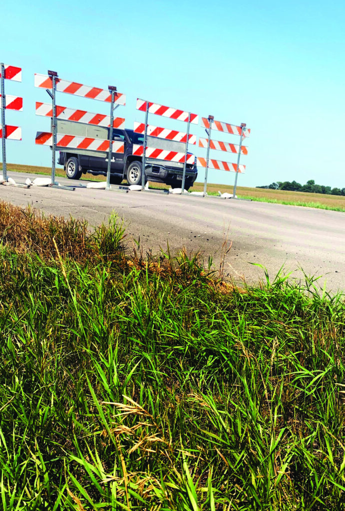
The bank of the Red River on the west side of the bridge on Clay County Highway 36/Cass County 34 north of Georgetown slumped last week, causing the bridge’s closure. (Photo/Dave Overbo.)
Nancy Edmonds Hanson
Extremely dry conditions and the region’s unstable soil have prompted the closure of another bridge across the Red River.
This one is one mile north and one mile west of Georgetown. The lengthy span crosses the river between Clay County Road 36 and Cass County Road 34 just north of Argusville. About 45 vehicles cross the river there each day, including farmers with land in both Minnesota and North Dakota. It was built in 1946; a section was added to the approach on the Minnesota side in 1993.
The road approaching the bridge from the west was observed to be slumping badly on Friday, according to Clay County Engineer Dave Overbo. It has been closed to traffic since then because the sliding ground makes travel hazardous.
Its future is up in the air. “When the water is so low in the river, there’s less hydraulic pressure in the river channel to support the banks,” Overbo explains. The area’s clay soil – a problem in so many projects – also contributes to the challenge. “If the soil has stability issues, as ours does, they’re noticeably greater when the weather is extremely dry.”
This is the second area bridge to be closed because of similar issues. The North Broadway bridge was blocked off in February when the north pier on the Fargo showed measurable slippage affecting the abutment, the area that connects the bridge to land on the shore. Three alternatives are currently under consideration: Closing the bridge permanently;
rebuilding it at the current level, which is vulnerable during floods; or rebuilding it at 37 feet, above flood stage.
Residents are being surveyed on which option they prefer. “At first, everyone says, ‘Rebuild it,’” Overbo observes. “But when you attach the cost, something like $5 million for the lower option and $10 million for the higher one, it may be a different story.”
One factor affecting opinions may be the Wall Street bridge less than a quarter mile from North Broadway. The Wall Street crossing already has carried more than twice the traffic of the closed structure – 5,200 vehicles per day, compared to just 2,250.
No such nearby alternative exists for the Georgetown-area crossing, with the nearest bridges 6 miles north and 8 miles south.
MNDOT will inspect the situation on its regularly scheduled fracture-critical bridge inspection next week. The North Dakota Highway Department will conduct a similar exam in coming weeks.
At the minimum, Overbo says, MNDOT may recommend lowering the speed limit on the sliding section. At maximum? If they find major issues with the abutments on the North Dakota bank, they may recommend closing it for good. Cost of replacement could be twice that of North Broadway, he says, since the Georgetown bridge is three times as long as the one in town.
These problems are not unexpected in a year as dry as this one. The Clay County Highway Department itself is working on two other bridges, one on the Red four miles south of Georgetown and another in Moland Township on the Buffalo River 10 miles northeast of Moorhead. “In Moland Township, the edge of the roadway dropped 2 feet,” Eidbo reports.
The issues with slumping clay soil that once lined the bottom of ancient Lake Agassiz are nothing new for engineers in the region. From the notorious Stockbridge Fill near Glyndon, where 100 years ago Northern Pacific civil engineers finally gave up finding stability, to Moorhead’s problem-plagued SE Main/20-21st Street underpass, Red River Valley gumbo has proven to be a perennial challenge.
“I wouldn’t say this year is catastrophic,” the Clay County engineer muses. “But three bridge problems in the last year is certainly out of the ordinary – not to mention other slumping problems along our ditches.
“There are hundreds of feet of gumbo under these river channels. It can be solved – but it’s tricky, and it can be expensive.”


