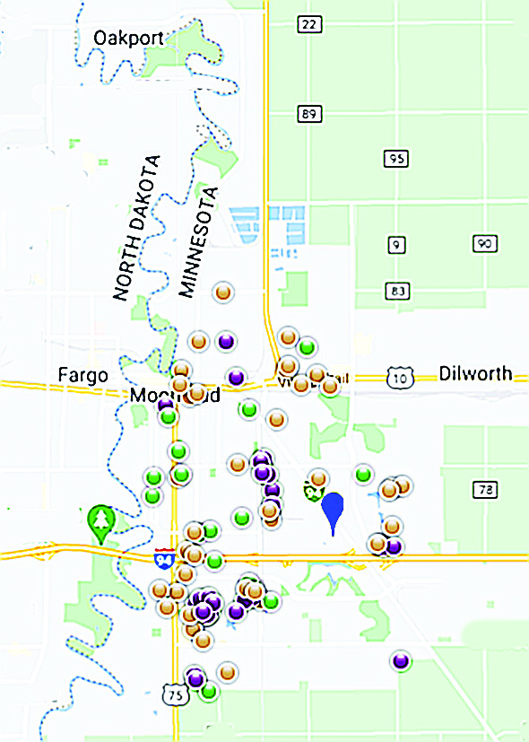
Have you seen Moorhead police cars, lights flashing, pull up to the curb nearby or heard sirens and wondered, “What’s going on?” The Moorhead Police Department has reintroduced an online map that reports most calls for service, giving residents an opportunity to assess trends and potential safety issues across the city.
The online site – www.communitycrimemap.com – is updated daily with icons representing many types of calls for service across the city. Users first search for “Moorhead,” then filter the incidents to be displayed on their devices. A crime has not necessarily occurred in every instance. To protect the privacy of victims, the address of each incident is rounded to the nearest block and the corresponding icon is placed anonymously on the map. Certain sensitive call types are not be displayed.
Among the reported actions represented by icons are assault, attempted homicide, robbery, burglary and other kinds of theft, DUI, missing persons and runaways, sexual assault, arson, traffic incidents and other offenses. To access the information, go to the website and enter “Moorhead” in the search bar.
MPD community policing coordinator Leann Wallin notes that the service is not new; the department has moved it to a new vendor and a new URL after about a year offline. “The mapping is another part of being transparent. It allows the public to know what’s going on in their neighborhood and around the city,” she says. In addition to local users, she points out its usefulness to those new to the city, like parents whose offspring are moving here for college. “We get quite a few calls asking about the safest areas for their kids to live,” she says. “This can help them decide.”
The crime map can also help residents stay safe. “If you can see activity in your area, you can take steps to prevent being victimized,” she points out. Law enforcement calls the practice “target hardening.” “It’s a matter of taking the common-sense steps to stay safe,” she adds, “like locking your house, closing the garage door, locking your car even in the driveway, and lighting up your property.”
While some who have read about the mapping on social media have responded that it seems to target disadvantaged neighborhoods, she explains it differently: “Areas with many apartment houses, for example, are going to be more densely populated, and more people means more calls for service. This information enables everyone to take steps to keep themselves and their homes safe.”


