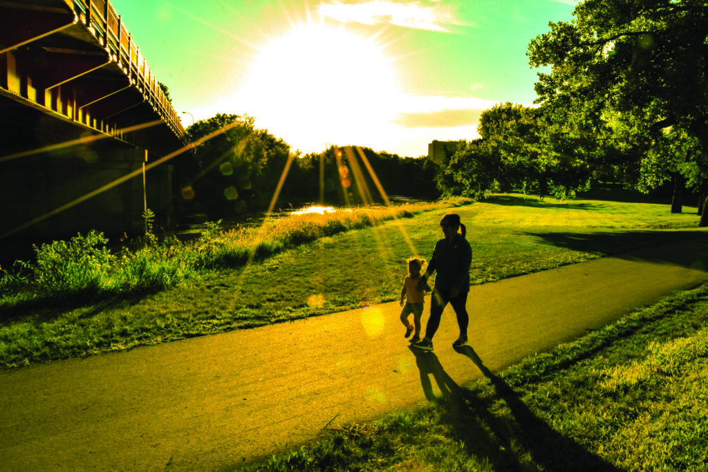
Moorhead’s Downtown Trail segment was completed in 2019. (Photo/Nancy Hanson)
Nancy Edmonds Hanson
Every cloud has a silver lining. Case in point: The Red River floods of 2009, 2010 and 2011 that cost Moorhead dearly have since bequeathed the city an outdoor recreation gift that now, a decade later, is slowly coming into focus.
The Red River Corridor Trail emerged out of the city’s unexpected acquisition of more than 200 acres of now publicly-owned property. As hundreds of homes built along the river were removed for flood control, prime real estate along the winding, wooded waterway moved from much-prized back yards into the public domain.
What to do with those highly desirable acres? In 2013, the Metropolitan Council of Governments collated the needs, issues and opportunities presented by access to the river corridor, along with public input from both sides of the river. The next year, Moorhead’s Mayor Del Rae Williams and the city council approved a plan for the river corridor that laid out alternatives for making the tangled brush, trees and banks along the notorious river into an asset that would make Moorhead proud.
Today, six years after the plan was adopted, that dream is much closer to reality. Construction equipment is shaping the Blue Goose Trail, the route along the levee from Gooseberry Park to the Bluestem Center for the Arts – thus the name. It’s the latest of eight segments that will ultimately connect into a continuous18-mile bike and pedestrian path from Oakport on the north to the 60th Avenue bridge on the south. Some segments of the trail, particularly the northernmost Oakport Trail, follow existing roadways. Most of the rest tracks the river’s twists and turns, clearing the way for concrete or asphalt family-friendly routes.
Community development director Kristie Leshovsky has been the point woman for the multi-year project. She works with a committee representing several departments – Parks and Recreation, Public Works, Planning and Engineering – that has considered not only the possibilities of building the pathways, but keeping it open and accessible throughout the year. “Our commitment is to 365-day access,” she says.
The first chunk of the system was added in 2015 when Clay County designated bike lanes along Wall Street, 17th and 11th Streets North to 15th Avenue North. The Greater Minnesota Parks and Trails Commission approved grant funds for the next two segments: the Homestead Trail, reaching from west of Matson Field to the Oak Grove pedestrian bridge, and the Downtown Trail that picks up there, dips under the three midtown bridges and leads to Woodlawn Park. The city helped fund construction (and in some cases, reconstruction) of that system, along with connecting segments.
Today those parts of the trail are bustling later in the day and on weekends with serious bicyclists, families rolling along together, younger folks on skateboards and inline skates, and people of all ages – some complete with leashed dogs – taking in the fresh riverine air. “People I know are very excited about the trails,” Kristie says, “not only about using them for exercise, but all the possibilities they suggest for future developments.” She cites the Historical and Cultural Society of Clay County, which is planning interpretive signs along the site of Moorhead’s earliest settlement, as well as marathon planners and arts groups interested in everything from a sculpture walk to festivals along the riverfront. “The trail is the backbone. We can do so many things along it.”
“We’re so grateful to the Minnesota Department of Natural Resources and the Legislature, and of course for the Legacy Fund,” she stresses. “Without their support, we wouldn’t have made the progress we have.” The completed Homestead Trail came in at more than $723,000; the downtown stretch was more than $500,000. Work now underway on the Blue Goose is expected to total $750,000.
The process of securing grants to pay for development can be frustrating. Many versions have been submitted, denied, reimagined and submitted again. The current work on the Blue Goose segment is underwrittern by a combination of MnDOT’s Transportation Alternative Program and city parks funds. She is currently continuing to seek an angel to invest in the Midtown Trail, the segment between Woodlawn and Gooseberry Parks, whose cost is estimated at $758,000. The southernmost segment, dubbed the Harvest Trail, is still a question mark; a recent application to the Transportation Alternative Program was denied.
Not all work along the river corridor is due to public investment. The city has partnered with Audubon Dakota in its Urban Woods and Prairies Initiative, shepherding the return of native plants and trees to segments of riverbank in the Oakport area, under Interstate 94, on Riverview Circle and in River Oaks Park. FM Trailbuilders set up trails in Gooseberry Park, and River Keepers has been involved in educational and environmental initiatives. Benches and garbage receptacles formed from recycled plastics are being added at strategic spots where visitors might welcome taking a break.
Someday, Kristie says, the River Corridor may be an attraction that adds luster to Moorhead’s appeal for visitors. In the meantime, it’s already a perhaps-underappreciated asset to those who live here – living proof that the light does eventually break through the darkest skies, and clouds do have silver linings.


